A new mapping system could now help emergency services manoeuvre inside buildings just as expertly as they navigate through streets to get to incident sites.
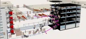
Hosna Tashakkori, a PhD student at The University of Melbourne, is creating a 3D representation of indoor maps to provide situational awareness and navigation assistance to emergency services.
Using her 3D model, Hosna hopes to guide rescuers through unknown buildings by showing them the optimum routes to follow inside the building before they get to the scene.
“This will tell each responder exactly which door to enter the building, which path to take, and where to exit,” reveals Hosna.
“The problem is that first responders don’t know what to expect inside the building until they arrive,” explains Hosna. “Our system will allow emergency facilitators to accurately guide responders in and out of the disaster site safely and efficiently.”
Visual distractions like smoke, collapsed structures and blocked areas all increase the difficulty of indoor navigation at an unfamiliar site.
“To overcome these difficulties, I have mapped the indoor areas in 3D, adding it on top of current outdoor maps – like zooming in past the highest level on google maps,” says Hosna.
“I have developed a framework to accurately visualise the exact location of stairs, elevators, exits, hydrants and other emergency information required by rescuers.”
Hosna presented her research at Fresh Science Victoria 2015.
Fresh Science is a national program that helps early-career researchers find and share their stories of discovery. Over 30 early-career researchers nominated for Fresh Science Victoria, which was held at Scienceworks (training), Melbourne Museum (schools forum).
Fresh Science Victoria the Kelvin Club (public event) and was supported by Museums Victoria, Bio-Medical Research Victoria and the Office of the Victorian Lead Scientist.
Contact: Hosna Tashakkori, The University of Melbourne, stashakkori@student.unimelb.edu.au
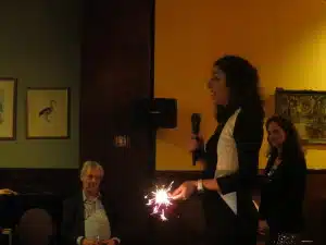
Bright spark: Hosa presenting at Fresh Science in the pub
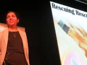
Hosna presenting at the schools forum



 Fresh Science is on hold for 2022. We will be back in 2023.