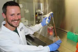
How does the Earth’s surface evolve? A geologist is using 3D animated reconstructions to explore ancient landscapes.
Geologists at the Department of Earth Sciences at La Trobe University, Melbourne have developed the world’s first animated model which can replay the history of the earth’s crust over millions of years to recreate eroded mountains and forgotten river systems.
The model, which will be demonstrated publicly for the first time at ScienceNow, travels back through geological time to show how Victoria looked when it was part of Gondwana 200 million years ago.
‘The results of our new model for south-eastern Australia are quite stunning – we can now visualise mountains that nobody has ever seen before,’ says Dr Roderick Brown, who developed the technology with La Trobe colleagues and Dr. Kerry Gallagher at Imperial College, London.
From a vantage point way above the Tasman Sea, the model shows in graphic 3-D colour a changing landscape of mountains rising and river valleys extending and filling as it rewinds 200 million years of history in one minute.
At 40 million years ago, the Murray River floods out as far as the Otway Ranges. At 90 million years ago the Mornington Peninsula rises rapidly to a greater height than the Dandenongs. At 140 million years ago, Gippsland fills out and rises to 750 metres. At 200 million years back, a mountain range soars to 3,300 metres from the New England plateau, now just a ‘pale insignificant vestige’ of its once dramatic peaks.
The new technology, which adapts the principles of Darwin’s theory of evolution, ends a 200 year quest by earth scientists for a way of recreating past landscapes back through geological time.
Dr Brown says the model can potentially be used to locate mineral deposits. In Africa, De Beers has used the technology to turn back the clock in their search for ancient alluvial diamonds deposited by rivers now lost or hidden below sediments in the modern south African landscape.
The researchers have harnessed the properties of genetic algorithms to solve an otherwise intractable problem: that of having to choose between many millions of possible landscape models.
Genetic algorithms (or GA’s) are based on the rationale that the robustness of life arose through evolution by natural selection – survival of the fittest, in other words. Algorithms create an initial set of random solutions that are allowed to reproduce based on their relative fitness (i.e. how well they explain the available input data).
These ‘genes’ or solutions are more likely to be passed on to the next generation than those of weaker models. The algorithms are amazingly efficient at finding optimum solutions to very complex problems.
‘This is the first time that anybody has attempted to use this approach to reconstruct landscape histories over such long time scales,’ Dr Brown says.
The new technology is based on an analytical method, called apatite fission track analysis, which can measure the range of temperatures that a rock has experienced back through geological time.
‘Temperature within the Earth increases with depth, so if we can find out when a rock was at a given temperature then we can work out how deeply it was buried at the time,’ Dr Brown says.
‘This tells us how much material was removed by erosion in order to expose the rock at the Earth’s surface. So we can simply rebuild the landscape by replacing the missing rock that was removed by erosion.
‘It’s ironic really, geologists were able to provide Darwin with the vast amounts of time his evolutionary theory of life required, and now this very theory is enabling geologists to travel back through time’
As well as economic applications, the new technology is a major advance in the wider effort to understand how long-term changes in regional continental topography have controlled global climate patterns.


 Fresh Science is on hold for 2022. We will be back in 2023.